Lake Buchanan, TX
Subject to Change as Conditions Develop Lake Buchanan Dam
It's really pretty sad. We use to have three or four cafes and stuff like that…. Nowadays a lot of our population is older folks, retirees. So those cafes were pretty much the center of things. Now we don't even have one left anymore. There's one trailer that sells burgers and fast food, but other than that, you can't go anyplace for a plate lunch and a cup of coffee.
—Karon Milam whose family owns a local charter fishing business along Lake Buchanan
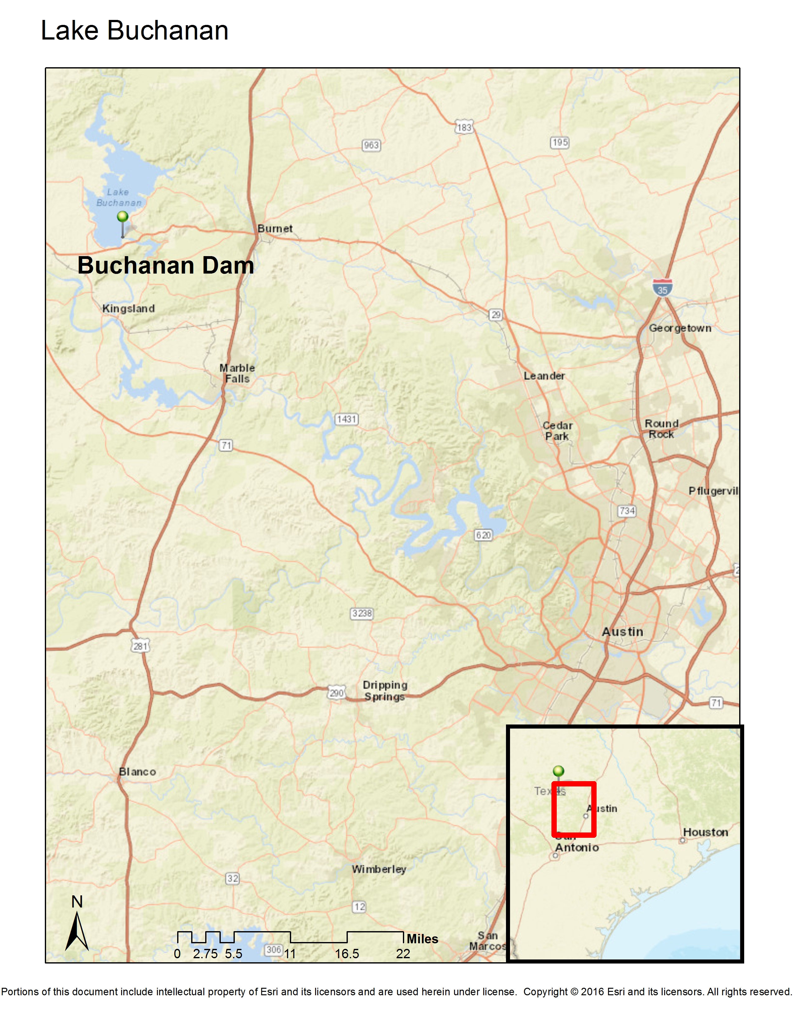
Located 60 miles northwest of Austin, Texas, the Lake Buchanan Dam was built in 1938 on the Colorado River in the Texas Hill Country of Llano County. Houses and businesses in Old Bluffton—a small farming town founded in 1859—as well as nearby farms were purchased either voluntarily or involuntarily through an eminent domain process. Twenty-two thousand acres of river basin was flooded to create the lake 31 miles long and five miles wide.

Eminent domain and change are intertwined in the case of Lake Buchanan. There were the few families displaced from farms that would ultimately be underwater. There was the town that was moved. The newly-created lake was an effort to reduce the extreme cyclical changes—floods and droughts—that negatively affected this area of Texas. However, the recreational area established as a positive by-product of the dam and newly-formed Lake Buchanan, was also to see extreme change in the early 21st century decades after its formation.
As with other water-inundation eminent domain sites, a price was paid by existing residents. Although the 50 families displaced was small in comparison with the populations that benefited and the new businesses developed, residents in Old Bluffton saw homesteads and farmland taken away from them.[1] Today the children, grandchildren, and great-grandchildren of those displaced repeat stories of this loss.
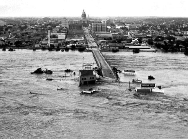
However, the project was seen as having multiple benefits. The dam was expected to control floods and protect homes, businesses, and farmland further down the river. A 1900 Colorado River flood cleared a mile-wide path through the center of Austin. The dam was expected to provide a more even water supply for nearby farms and cities in a state known for dramatic swings between floods and drought. The catastrophic dust storms of 1934 and 1936 had already devastated other parts of Texas, destroying farmland and displacing residents and setting off a historic migration out of these other regions of Texas and Oklahoma. The dam and the resulting lake represented insurance against future floods and droughts.

[Colorado River Flood], Photograph, June 15, 1935; (http://texashistory.unt.edu/ark:/67531/metapth124019/: accessed January 31, 2016), University of North Texas Libraries, The Portal to Texas History, http://texashistory.unt.edu; crediting Austin History Center, Austin Public Library, Austin, Texas.
There are other benefits as well. New hydroelectric power generated by the dam was also seen as an engine for industry and commerce as the region and the entire country was trying to pull itself out of the Great Depression. Increased irrigation capacity would benefit farmers. It created a new lake that could become a new recreational area. In fact, Lake Buchanan became the most visible outcome of the dam project, as resorts, motels, restaurants, and boating businesses emerged on its shores.
In 2012 when Richard Wasserman’s photographs were taken, Lake Buchanan water levels had fallen to historical lows as a result of the longest drought since the dam had been built. With the dramatically shrunken lake came the loss of tourists, the closing of motels, the boarding up of restaurants, and the decline of the area’s economy. Although the project was designed to moderate the ups and downs of Mother Nature’s water machine, it was meeting its limits.
In 2015 multiple heavy rain storms and floods have started to bring Lake Buchanan’s water levels back from historic lows. While Lake Buchanan’s tourist economy may be on the rebound, the elusive long-term goal that the eminent domain project would even out the variations of weather cycles is underscored more than ever. As put by the qualifying statement on the Lower Colorado River Authority’s web site under the “daily lake level” report: “Forecast is subject to change as conditions develop.”[3]
[1] Robyn Ross, “Bluffton: Texas’ Lost Civilization Rises from Lake Buchanan.” Texas Observer. Nov. 14, 2012. http://www.texasobserver.org/bluffton-texas-lost-civilization-rises-from-lake-buchanan/ Accessed January 18, 2016.
[2] University of North Texas Libraries, The Portal to Texas History, “1935 Austin Flood.” http://texashistory.unt.edu
Photograph, June 15, 1935. http://texashistory.unt.edu/ark:/67531/metapth124019/. Accessed January 31, 2016.
[3] Lower Colorado River Authority. 2016. “Situation Report” (Lake Buchanan). http://floodstatus.lcra.org/. Accessed January 18, 2016.

